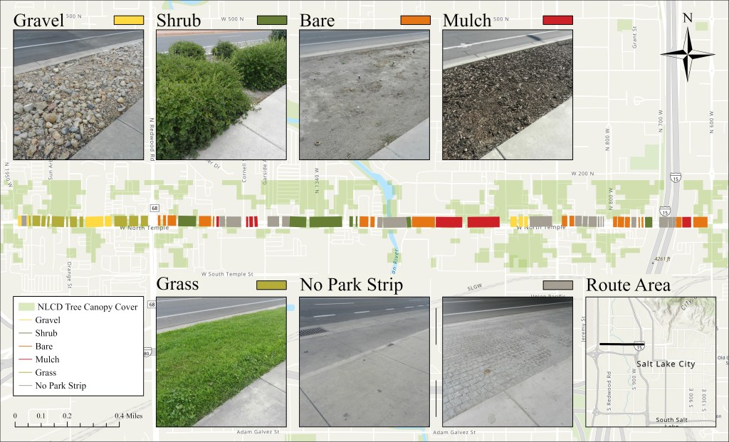
As part of a broader study on pedestrian heat exposure, Evan Klansnic mapped park strip cover along a 3.25 km segment of West North Temple in Salt Lake City. Each segment was classified as grass, gravel, bare, mulch, shrub, or no park strip using high-resolution aerial imagery and field verification. Tree canopy cover was derived from the National Land Cover Database (NLCD) 30-meter raster.
Evan used ArcGIS Pro to digitize the segments and overlay them with NLCD canopy data. Each strip was classified based on dominant surface material (>50% of segment length), and shaded areas were identified through raster overlay. This GIS layer supported the spatial matching of mobile heat index data collected along the route using wearable sensors.
This map served as the foundation for analyzing how small-scale land cover and shade influence pedestrian heat exposure. You can view the full research here.
